We accompany the customer through the entire procurement process. We assist clients with equipment selection and provide a tailormade mission suite design. We oversee everything from the smallest details to the big picture.
From Airframe to Surveillance Platform
We offer fast & flexible integrated mission solutions for fixed-wing, rotary-wing aircraft and unmanned aerial vehicles to help our clients achieve their various important & special missions be it Search & Rescue, Aerial Surveying, Airborne Law Enforcement, Maritime Patrol or even Intelligence, Surveillance & Reconnaissance operations.
Whatever technical sensor, communication system or special aircraft configuration you need for your mission – We make it airborne!

“We turn general aviation aircraft into special mission platforms.”
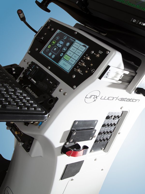
We are your One-Stop-Shop for Integration & Modification Excellence
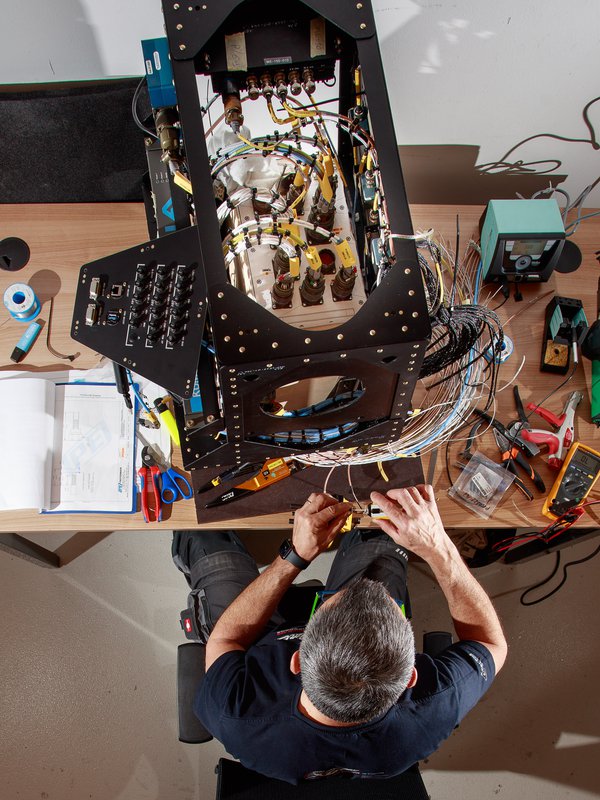
We design, integrate and certify state-of-the-art special mission equipment and systems into new & existing airframes.
We meticulously manage every step of the integration and modification process from design, engineering, production, installation, testing to EASA certification.

April 2026
Proud to Support Airbus in the A400M Program
We are proud to announce that Airborne Technologies has been selected as system integration partner by Airbus Defence & Space, supporting the A400M program.
This collaboration represents an important milestone …
We are a cut above the rest
We unite highly trained experts from all critical industry sectors (aviation, engineering, areal surveying, public safety defense & business) under one roof.
We are impartial, unbiased and especially not alligned with any supplier. However, we have a great working relationship with many estalished aircraft sensors and communication manufacturers worldwide.
Operating our own fleet of aircraft and sensors, along with the availability of our own special mission demonstrator aircraft, gives us the expertise and experience of relating with our customers at eye level.
Our focus is innovation balanced with accountability. We research what is truly effective for the client's mission and determine the right innovative technical solution. On top of that, we are quick to act, respond, organize and engage with our clients at every project stage.
Your Mission is Our Business
Designed for Precision
